


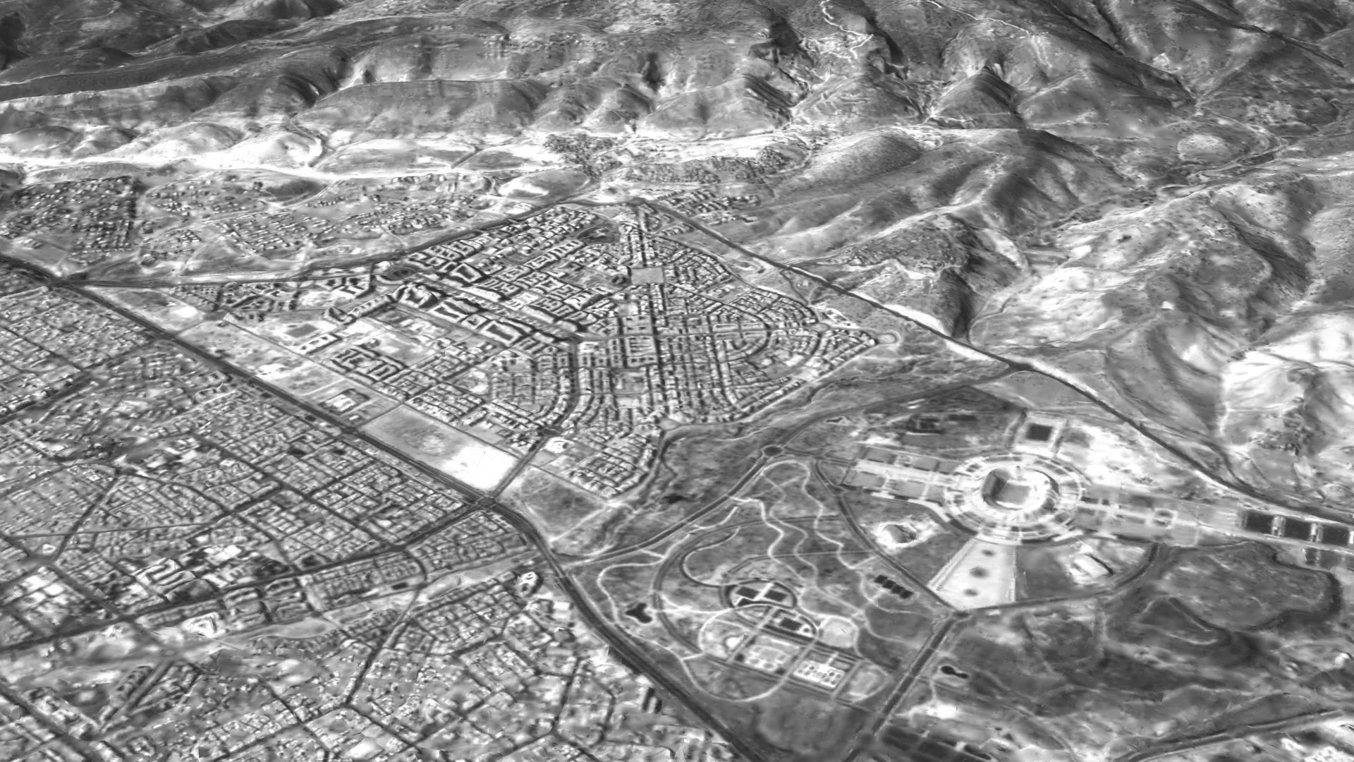
This update focuses on Agadir 3D model. A detailed 3D model of Agadir has been created from images captured by the Russian satellite InnoSat16, a technological step that could eventually support urban planning, tourism and property projects closely followed by Moroccans living abroad.
An Agadir 3D model seen from orbit
According to Russian media, the company Geoscan used images from the InnoSat16 satellite to build an Agadir 3D model. The firm combined satellite imagery with photogrammetry, a technique that reconstructs shapes and relief from multiple photographs.
The result is a three-dimensional representation of the city and its surroundings. Geoscan also produced a video simulating a flyover of Agadir, highlighting the coastal relief and urban districts.
For Moroccans abroad with ties to the city, this type of Agadir 3D model offers a precise view of how the territory is evolving, useful to track new developments or the expansion of certain neighborhoods from a distance.
How the InnoSat16 satellite works
Launched on 25 July 2025 from the Vostochny Cosmodrome, InnoSat16 is presented as Russia’s first 16U CubeSat in orbit. Its main payload is a panchromatic camera developed by NPO Lepton.
This camera captures black-and-white images of the Earth’s surface with a resolution of 2.5 meters per pixel, from an altitude of about 500 kilometers. Geoscan says the this case project demonstrates the guidance, attitude control and stabilization capabilities of the satellite, which can deliver high-quality images.
Since 2021, Geoscan has launched 17 small satellites dedicated to scientific experiments, communication technology tests and Earth observation. This growing constellation shows how private actors increasingly shape mapping and monitoring of territories.
What does this mean for Moroccans abroad?
In the short term, this 3D model is not a public service directly offered to Moroccans abroad. But it shows how satellite data may, in the future, make several return and investment plans easier to prepare from overseas.
- better visualization of urban areas before a property purchase;
- remote monitoring of new infrastructure and development projects;
- more accurate tools for local authorities and urban planners.
For a Moroccan abroad planning a return to Agadir or an investment in the region, the growing use of 3D models could eventually help understand zoning plans, natural risks or future transport and tourism infrastructure.
These technologies are part of a broader move to digitize territory-related data. Combined with official Moroccan databases, they could improve transparency around projects and geographic information accessible from abroad.
Data that must be governed and leveraged
The involvement of foreign private players in producing detailed models of Moroccan cities also raises questions about data governance. Who will be allowed to access these models? Under what conditions could they be used for urban development, tourism planning or insurance?
Moroccan public authorities remain the reference point for official use of territorial data, including cadastre, urban planning and digital services. Moroccans abroad preparing procedures in Morocco can still rely on official channels, including the dedicated portal for Moroccans living abroad.
For now, the this issue is mainly a technology demonstration by Geoscan and InnoSat16. Still, it signals how the orbital view of Morocco could, in the medium term, become one more tool for Moroccans abroad as they plan returns, trips or investments back home.
For more context, readers can follow Canal212 news for Moroccans abroad.
Don’t miss out on the latest news from the diaspora!
Sign up for our next newsletter to receive our practical guides, advice (on procedures and investment) and the latest news for French nationals living abroad, delivered straight to your inbox.